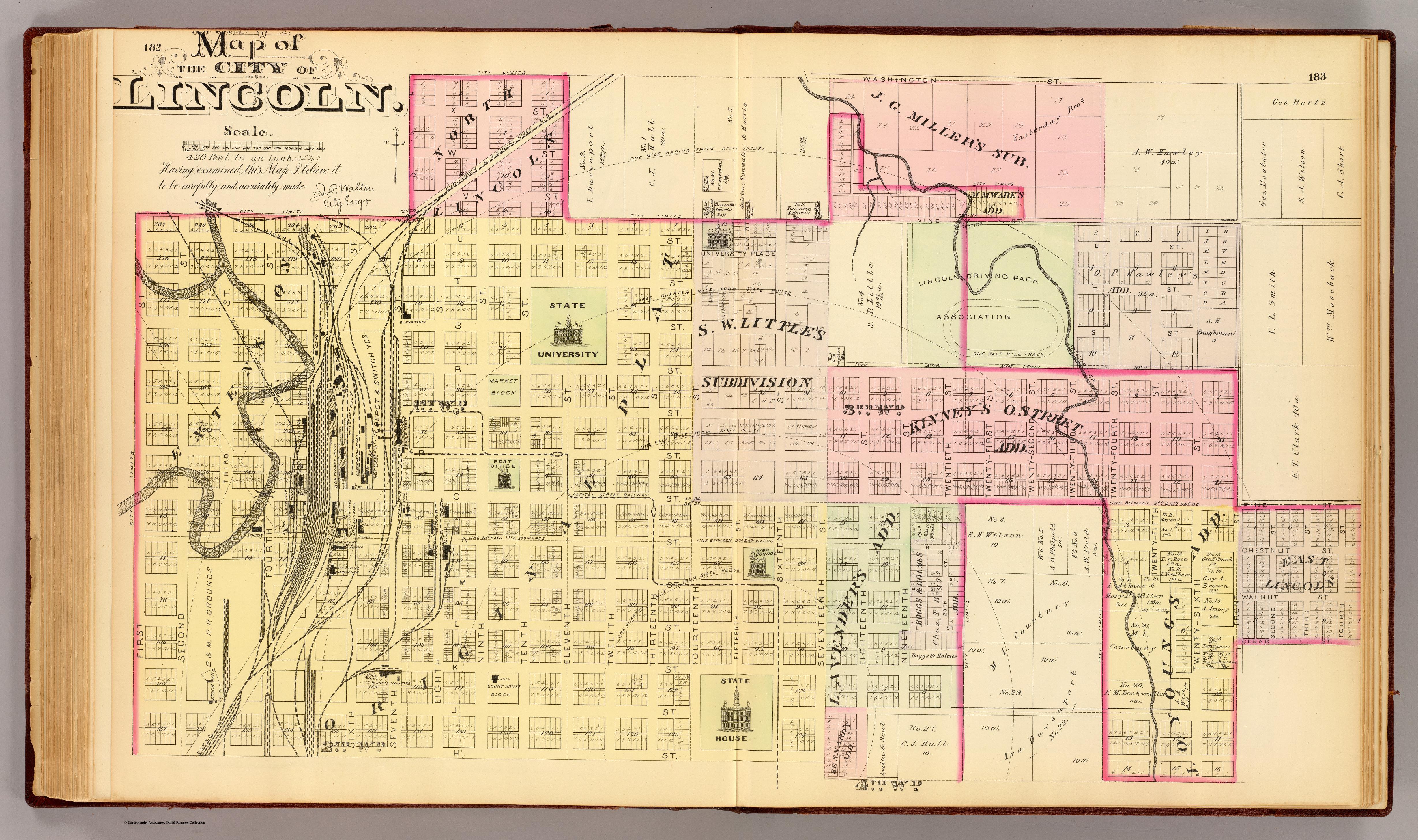
Map of the city of Lincoln. (northern sheet. Philadelphia, Everts & Kirk, 1885)
Title
Map of the city of Lincoln. (northern sheet. Philadelphia, Everts & Kirk, 1885)
Subject
Lincoln Map
Description
The North City of Lincoln. in 1885. Showing block and lot numbers, major buildings, railroads, street railroad and radial distances from State House
Creator
[San Francisco, Calif.]: Cartography Associates, c2002
Source
The official state atlas of Nebraska. 1885. Compiled from government surveys, county records and personal investigations.
Type
Image
Format
Jpeg.
Publisher
Philadelphia, Everts & Kirk, 1885. (on verso)
Date
1885
Contributor
Rumsey, David, 1944-
Rights
Digital images and descriptive data © 2000 by Cartography Associates.
Identifier
Image No. 2719173
Abstract
This is an image of a hand colored Lithographed map. Shows wards, tracts, block and lot numbers, major buildings, railroads, switching yards, street railroad, radial distances from State House. First published in Philadelphia: by Everts & Kirk. 1885
Date Copyrighted
2000
Access Rights
This work is licensed under a Creative Commons License.
Is Part Of
This historical cartographic image is part of the David Rumsey Historical Map Collection, www.davidrumsey.com,
Bibliographic Citation
Everts & Kirk. Map of the city of Lincoln. (northern sheet. Philadelphia, Everts & Kirk, 1885). Scale 1: 5,040. "David Rumsey Map Collection." 2000.
https://www.davidrumsey.com/luna/servlet/detail/RUMSEY~8~1~28220~1130170:Map-of-the-city-of-Lincoln---northe
https://www.davidrumsey.com/luna/servlet/detail/RUMSEY~8~1~28220~1130170:Map-of-the-city-of-Lincoln---northe
Original Format
Photograph
Physical Dimensions
Object Height cm: 44
Object Width cm: 73
Scale 1: 5,040
Object Width cm: 73
Scale 1: 5,040
Files
Collection
Reference
Map of the city of Lincoln. (northern sheet. Philadelphia, Everts & Kirk, 1885), [San Francisco, Calif.]: Cartography Associates, c2002, Philadelphia, Everts & Kirk, 1885. (on verso), 1885