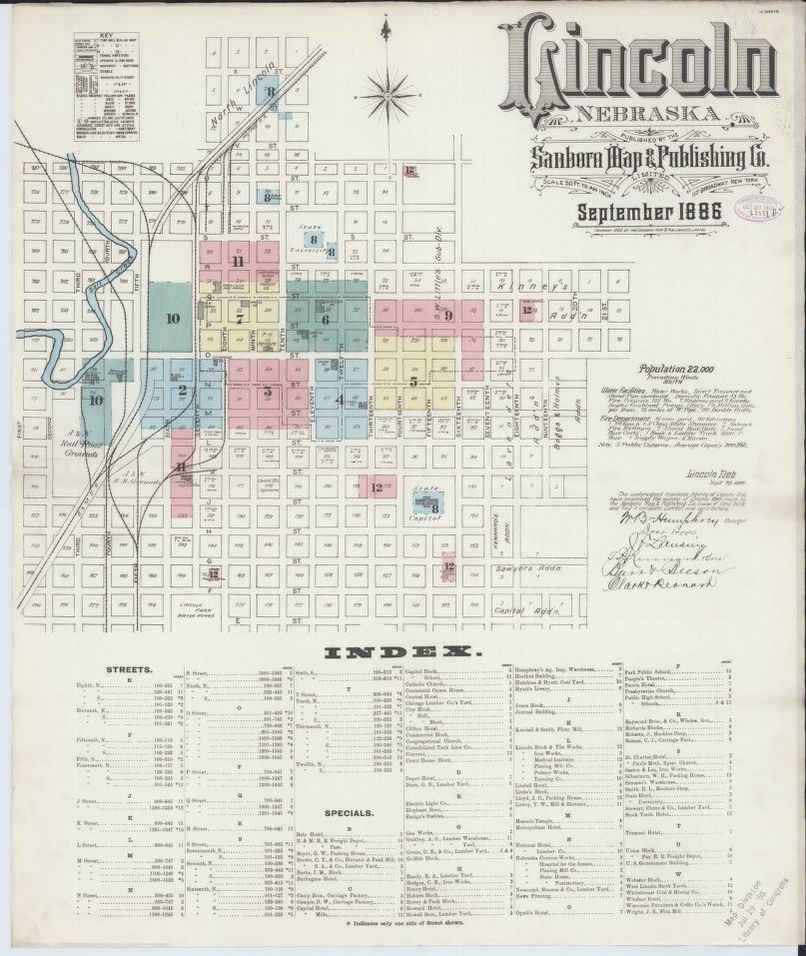
Sanborn Fire Insurance Map from Lincoln, Lancaster County, Nebraska.
Title
Sanborn Fire Insurance Map from Lincoln, Lancaster County, Nebraska.
Subject
LIncoln Map
Description
Image of The 1886 Sanborn Map of Lincoln in giving details of individual buildings. Published by Sanborn Company for insurance companies liability assessments. Image#1, the first of the 103 collection of Lincoln maps, shows the University of Nebraska Block #8 and surrounding areas.
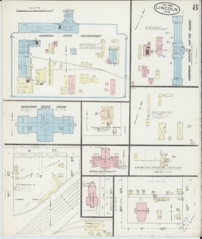
Image #2 shows details of the first university structure.
Image #2 shows details of the first university structure.
Creator
Sanborn Map Company, Sep 1886
Format
jpg
Publisher
The Sanborn Company
Date
1989
Rights
The Library of Congress is providing access to these materials for educational and research purposes and is not aware of any U.S. copyright protection (see Title 17 of the United States Code) or any other restrictions in the Map Collection materials.
Bibliographic Citation
(1903) Sanborn Fire Insurance Map from Lincoln, Lancaster County, Nebraska. Sanborn Map Company. [Map] Retrieved from the Library of Congress, https://www.loc.gov/item/sanborn05208_004/.
Rights Holder
Library of Congress Geography and Map Division Washington, D.C. 20540-4650 USA
Files
Collection
Reference
Sanborn Map Company, Sep 1886, Sanborn Fire Insurance Map from Lincoln, Lancaster County, Nebraska., The Sanborn Company, 1989